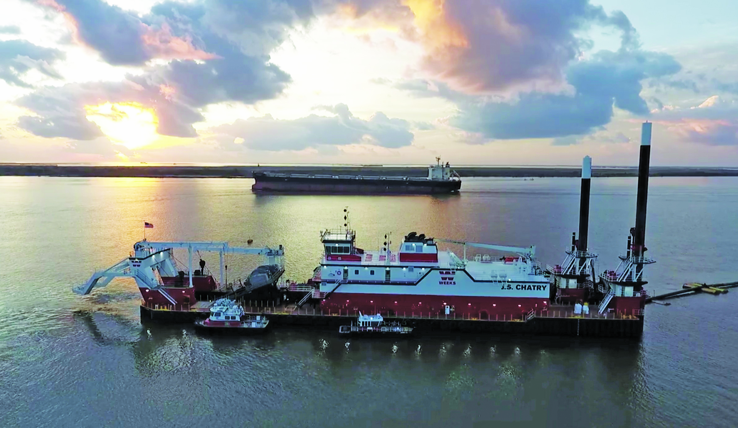
For the third year in a row, the New Orleans Engineer District is overseeing construction of an underwater sill across the bed of the Mississippi River Ship Channel. The sill is being built near Mile 64 above the community of Ironton, La., to slow the upriver intrusion of salt water from the Gulf of Mexico.
The Corps has contracted with Weeks Marine for construction of the sill, which will initially be built to an elevation of -55 feet to match the depth of the navigation channel. Weeks Marine’s cutter suction dredge J.S. Chatry, built at Belle Chasse, La.-based C&C Marine and Repair and completed in early 2019, mobilized to the area ahead of Hurricane Francine’s landfall September 11. Work on the sill, built from the river’s naturally occurring sediment load, began three days later.
“The sill on Saturday [September 14] was already about 28 percent complete, going up to that initial 55-foot depth,” said Col. Cullen Jones, commander of the New Orleans District.
Jones discussed the salt water sill as part of his remarks at the National Waterways Conference’s annual meeting, held in New Orleans September 18-19.
Because the Mississippi’s riverbed from Natchez, Miss., to the Gulf of Mexico is below sea level, salt water, more dense than fresh water, naturally pushes upstream at the bottom of the water column. In high water or normal flows, the river effectively holds the salt water at bay. Jones told the crowd gathered for the National Waterways Conference meeting that a flow of about 300,000 cubic feet per second (cfs) is required to push the salt water back toward the Gulf.
In times of extreme low water, though, a wedge of salt water is able to flow upstream. At press time September 19, the flow rate at Belle Chasse, La., just over 10 miles above the site of the sill, was 220,000 cfs. As the wedge of salt water moves upstream, elevated sodium and chloride levels threaten municipal drinking water and industrial water supplies.
According to the New Orleans District, the sill is a mitigation feature originally developed when the Mississippi River Ship Channel was deepened from 40 feet to 45 feet in the late 1980s. In just the past few years, the Corps has successfully deepened much of the ship channel between the Gulf of Mexico and Baton Rouge, La., to 50 feet. The sill essentially creates an underwater reservoir that contains the salt water below the larger population centers of upper Plaquemines Parish, St. Bernard Parish, New Orleans and Jefferson Parish until flow rates increase.
The Corps has overseen sill construction in 1988, 1999, 2012, 2022 and 2023. In 2023, the flow rate in the river was so anemic that the Corps was forced to augment the sill, raising it from -55 feet to -30 feet. To maintain deep-draft navigation, though, the Corps left a 620-foot-wide navigation lane in place at a 55-foot depth.
For more than 30 years, low water conditions forced the Corps to build the sill around once a decade. However, the behavior of the river has been different since the historic flood of 2019.
“The river is changing rapidly,” said Sean Duffy, executive director of the Big River Coalition, speaking at the National Waterways Conference meeting. “We’re seeing things in the river we’ve never seen before.”
Besides drought upstream leading to low flow rates on the Lower Mississippi, Duffy said bank destabilization on the east bank of the river below Bohemia, La., has led to flow loss and, at times, salt water intrusion from Breton Sound. Another issue is dredging at Head of Passes in low water, something that wasn’t needed in years past but has been a necessity the past few years to keep ship traffic moving.
“Long term, the metrics that we used to use don’t hold water any more,” Duffy said.
The Corps is in the midst of a five-year, $25 million mega study called the Lower Mississippi River Comprehensive Management Study. The study seeks to understand the dynamics at work in the Mississippi River between Cape Girardeau, Mo., and the Gulf and how best to manage and maintain the Mississippi River and its tributaries.
————
Featured photo caption: A ship passes the Weeks Marine dredge J.S. Chatry as it works on the Lower Mississippi River. (WJ file photo courtesy of Big River Coalition/P.J. Hahn)


