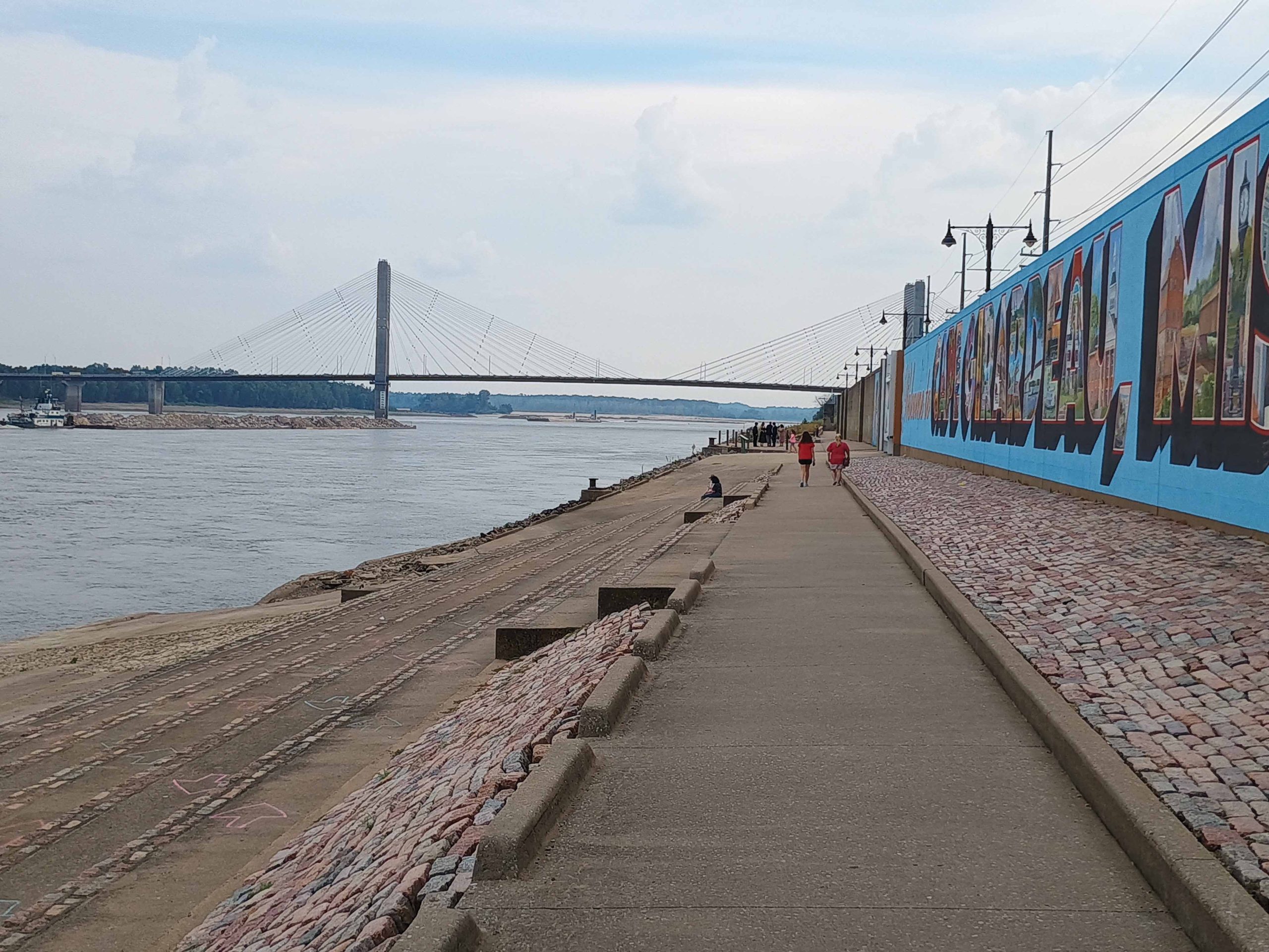
The Mississippi and Ohio rivers are falling again after a brief reprieve from passing rain showers.
In a September 26 Memphis Engineer District press conference, Mike Clay, hydrologics and hydrology branch chief, described a “flash drought” over the Ohio Valley and near its confluence with the Mississippi River in Cairo, Ill., following weeks with little rain. It was the driest August over the Ohio Basin in the last 131 years, he said.
Scientists are unable to predict the potential for rain with much accuracy more than two weeks in advance, Clay said.
“Right now, it’s very little where we need it for the next two weeks,” he said.
While no one wants the destruction brought about by a hurricane or tropical storm, he said storms forming in the Atlantic during the hurricane season could help bring moisture inland.
Zach Cook, regional channel improvement project manager, said one promising sign is that the river as of September 26 was 7 feet higher than it was at this time of the year in both 2023 and 2024. The record low set on the Memphis gauge was October 17, 2023, when the river was at -12.04 feet. It was also higher than at the same time in 2024.
As of 8 p.m. October 1, the Memphis gauge read -3.75 feet, according to data from the National Oceanic and Atmospheric Administration (NOAA). The forecast called for the river to continue to fall, however, with -8.8 feet predicted for October 15.
The coming days and weeks will be especially important as much of the harvest season in the surrounding region takes place in October and November, Cook said.
“We’re optimistic that we’ll get the rain and that the timing will be at just the right time in order to keep the river high enough for a long enough period of time that we need for the commercial interests to get all of their product out and to the market,” he said.
As of October 3, the Coast Guard, in conjunction with the Lower Mississippi Commission (LOMRC), planned to reduce maximum southbound drafts on the entirety of the Lower Mississippi from Cairo to the Gulf by 6 inches: from 10 feet, 6 inches to 10 feet, said Donnie Williams, LOMRC chairman. The maximum southbound width will remain six barges wide, he said. Northbound tows are restricted to six wide overall and only four if loaded, he said.
The dredge Jadwin was expected to finish dredging at Mile 483 (Lake Providence, La.) around October 2, Williams said.
Williams spoke with representatives from both the Coast Guard and Corps of Engineers regarding continued operation of buoy tenders and dredges during the federal government shutdown.
“Everything’s going to still operate as normal for now,” he said.
With the Memphis gauge expected to reach -7 feet by October 7, Williams said LOMRC was once again considering whether to switch the navigational channel to the right descending bank at Mile 922 at Hickman, Ky., where rock pinnacles and an underwater scour hole have previously caused navigation difficulties. The dredge Potter just finished working in that area to prepare for a switch to the alternative channel, if needed, he said. If the alternative channel is needed, it will require restrictions of tows no more than five barges wide and southbound traffic to transit the area in daylight hours only.
The gauge on the Ohio River at Cairo, Ill., was also falling rapidly, Williams noted, from a recent peak of 14.41 feet on September 28 to 9.6 feet October 1 and a forecast of 6.3 feet on October 15.
Williams summed up the situation in one sentence. “We need some rain.”
Farther south in the New Orleans District, Harvey Lock was closed due to reverse head conditions, with river levels lower than the canal side.
Beginning September 28, the U.S. Coast Guard implemented restrictions around Mile 67.5 on the Lower Mississippi due to construction of the saltwater sill, an underwater berm under construction to block the upstream movement of salt water in the river. All ship traffic between Mile 63.65 and Mile 63.91 is confined to a one-way 600-foot-wide channel that favors the left descending bank. All vessels transiting the area must contact the pilot aboard the dredge J.S. Chatry on channels 67 and 72 half an hour prior to arrival. Vessels should transit between Mile 63.5 and Mile 65 at their slowest safe speed.
————
Featured photo caption:
A tow approaches the Bill Emerson Memorial Bridge (Upper Mississippi Mile 51.5) September 20 in Cape Girardeau, Mo., as people walk along the floodwall murals. The lack of recent rainfall has led to low-water conditions on the nation’s navigable rivers. (Photo by Shelley Byrne)


