The U.S. Army Corps of Engineers charts approximately 7,500 miles on the Western Rivers, and the Corps’ Inland Electronic Navigational Chart (IENC) program updates and maintains a suite of 109 IENC cells covering those waterways.
Bridges are just one of the items included on the charts. Approximately 830 bridges have now been LiDAR surveyed to ensure that locations of bridge piers, decks, lights, gauges and other associated features are accurate. The surveys have also enabled the IENC program to provide updated clearance information, which the Corps shares with the U.S. Coast Guard.
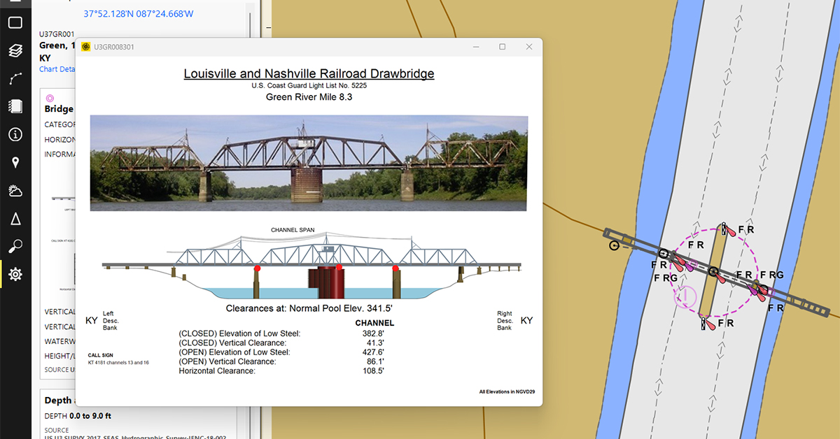
Each charted bridge includes a graphic called a pictorial representation, or PICREP, containing relevant information (bridge name, clearances, etc.). To date, though, there has been little consistency in the appearance of PICREPS across Corps districts.
The IENC program is now standardizing bridge information to ensure consistent formatting and inclusion of relevant details, including bridge name, the Coast Guard light list number, a photograph, a profile drawing, clearance information, reference data (gages, datums and water levels), call signs and phone numbers.
While the Corps has surveyed all of the bridges, generated bridge diagrams and obtained all of the relevant clearance and reference information, the agency is still missing photographs of 202 out of 830 bridges for inclusion in the PICREPs.
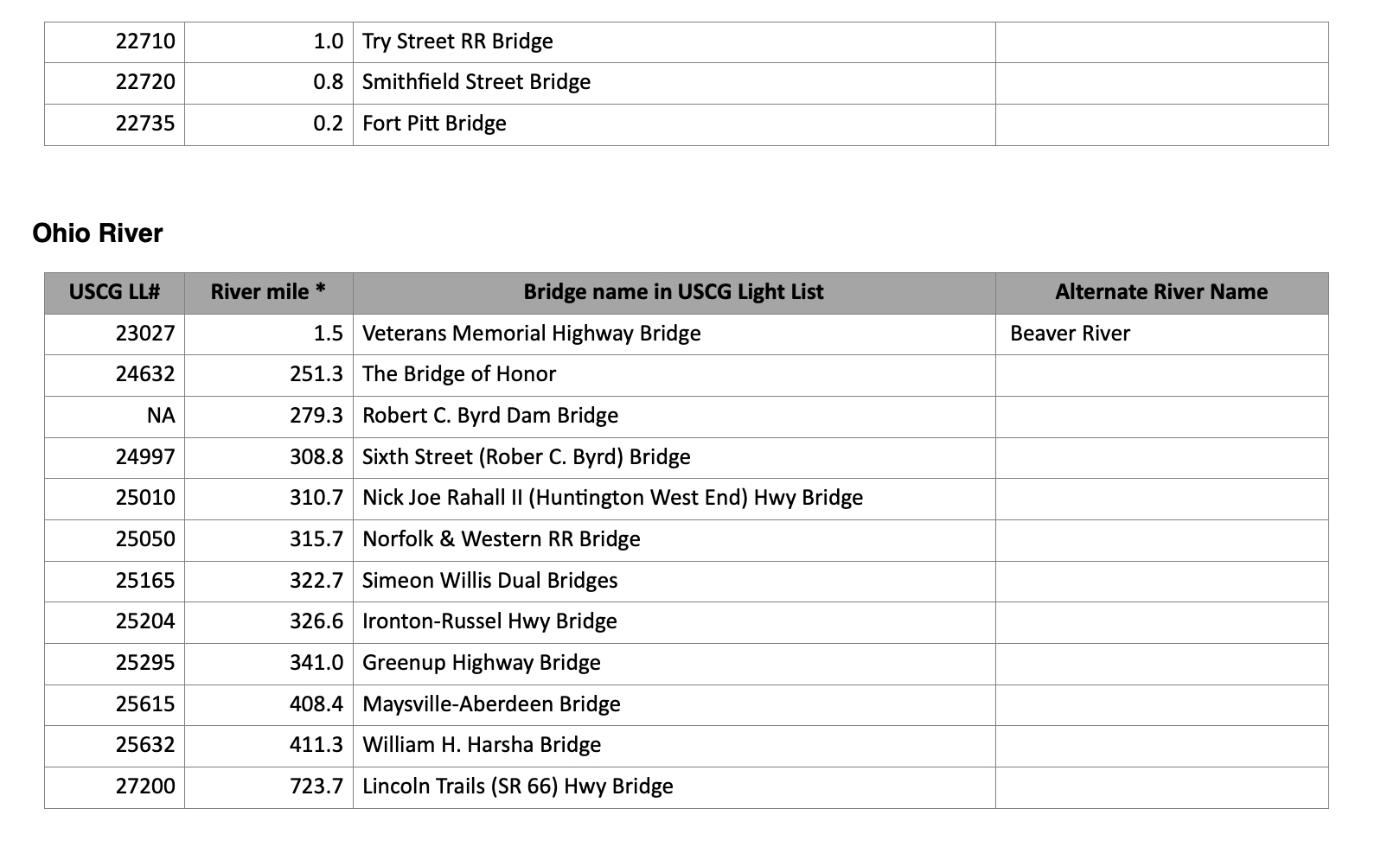
The Corps is asking inland mariners to submit photos of the remaining 202 bridges. Photos should be taken looking downstream, from within the channel and during daylight hours. Corps officials also asked for photos to include a view from bank to bank. Files should be saved as a JPG or PNG and be named for easy identification (e.g., using the river name & mile, Coast Guard Light List number or name from the Coast Guard Light List).
“Of course, while on the water, only photograph bridges and submit them to us if it is safe for you to do so,” said Denise LaDue, IENC program manager. “If you have any questions, please email the IENC team at AGC-IENC@usace.army.mil.
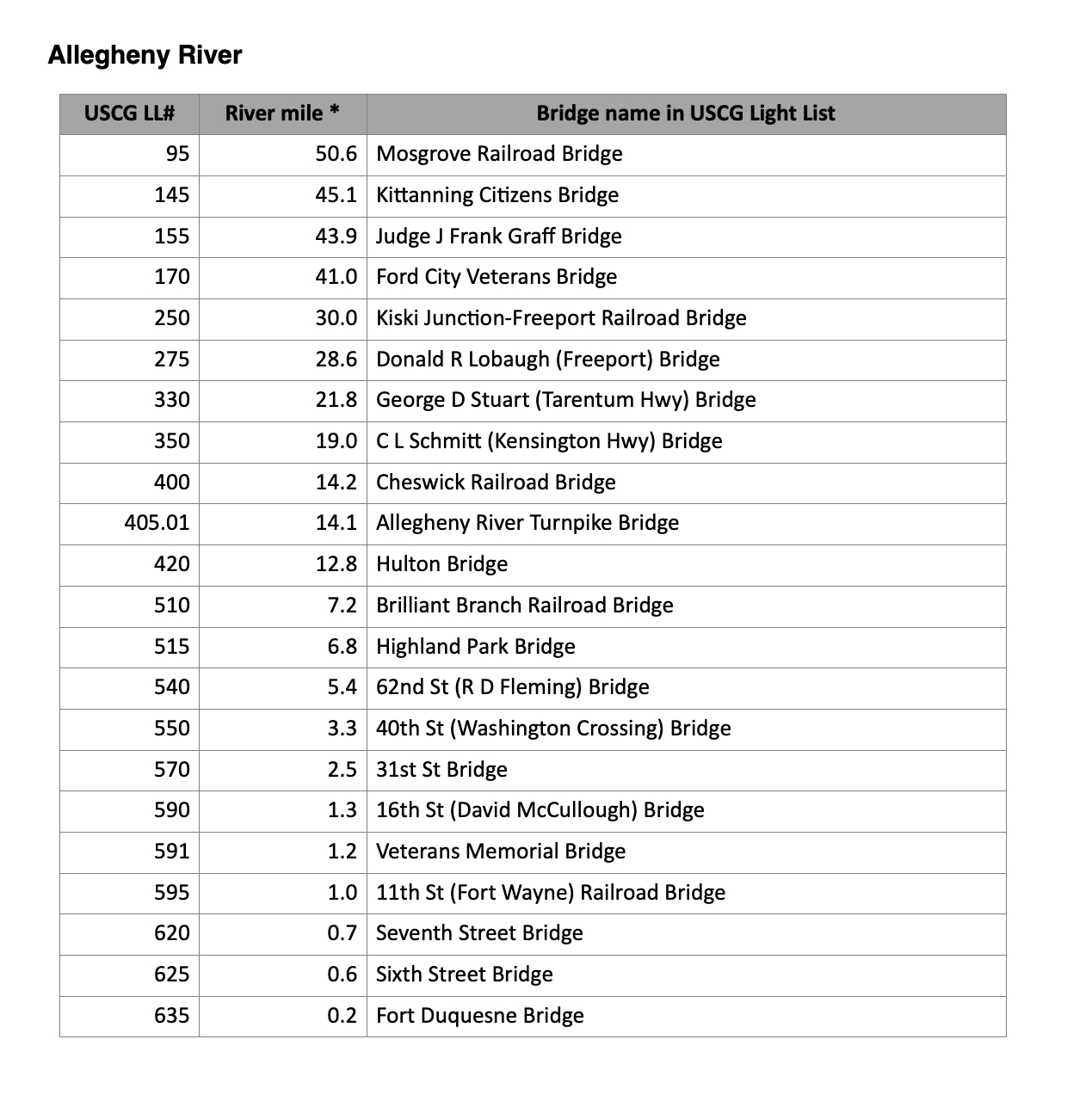
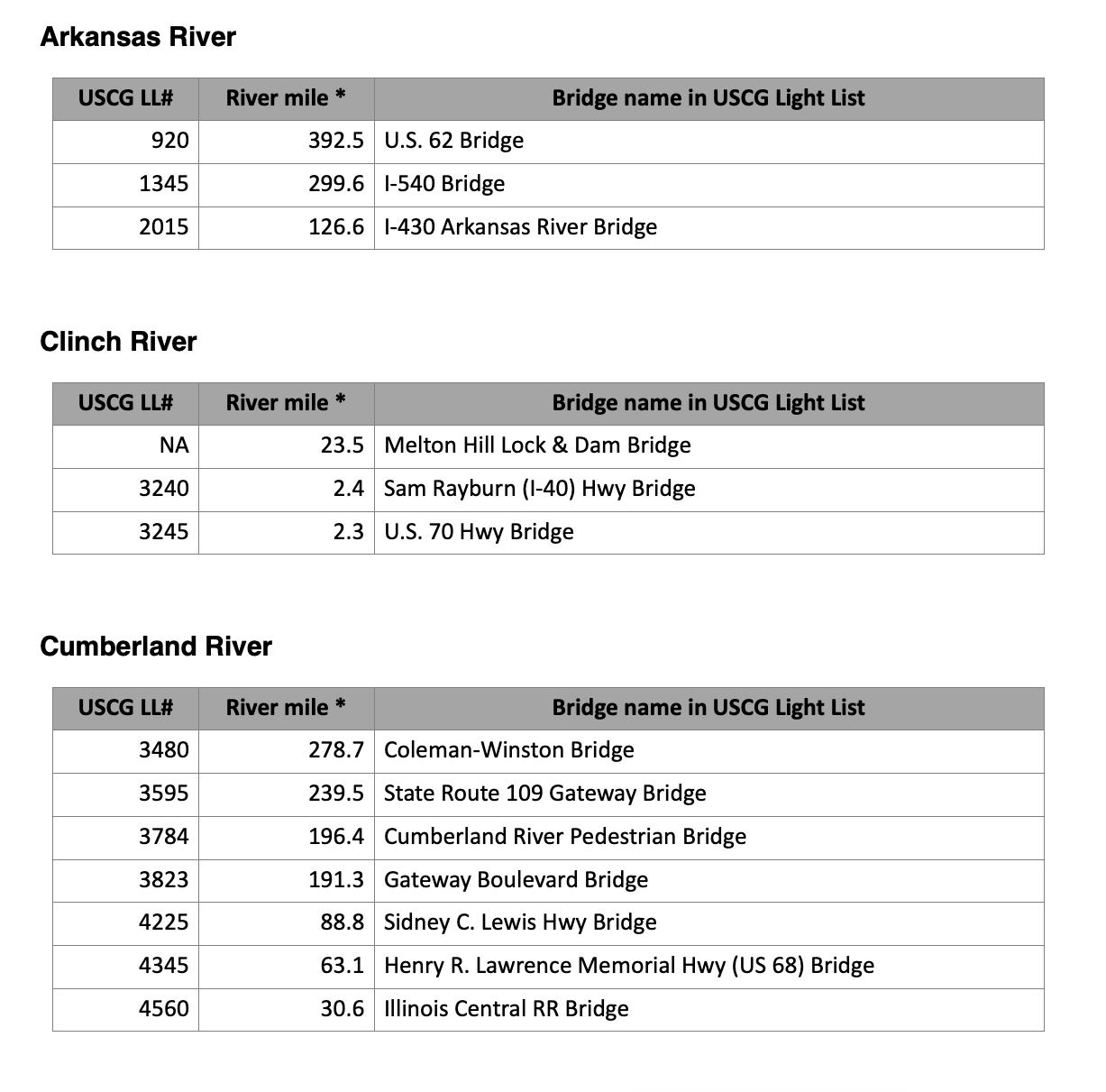
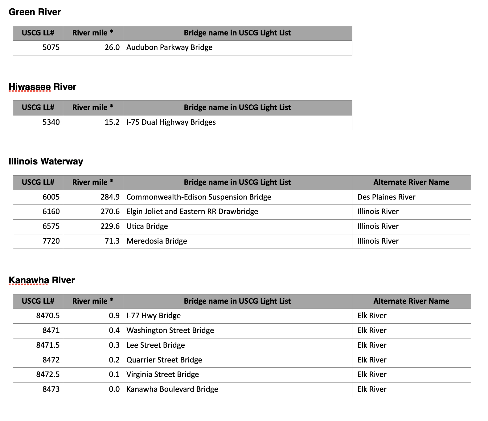
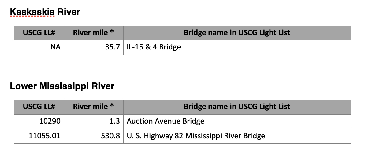
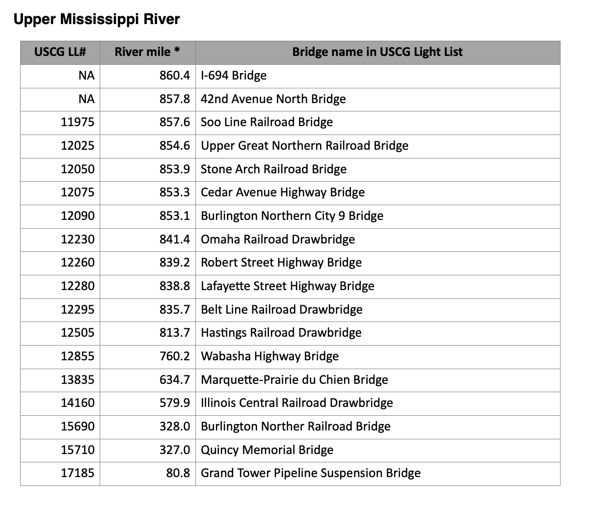
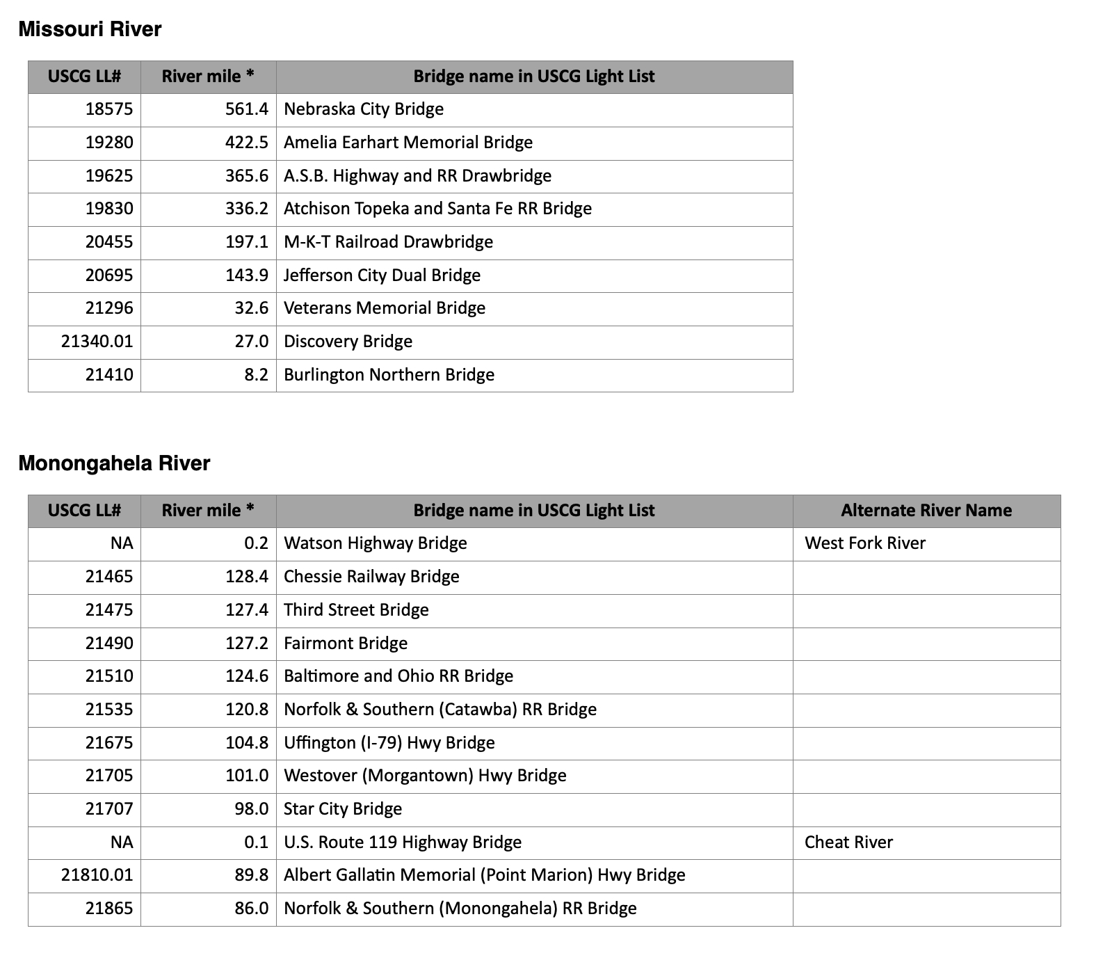
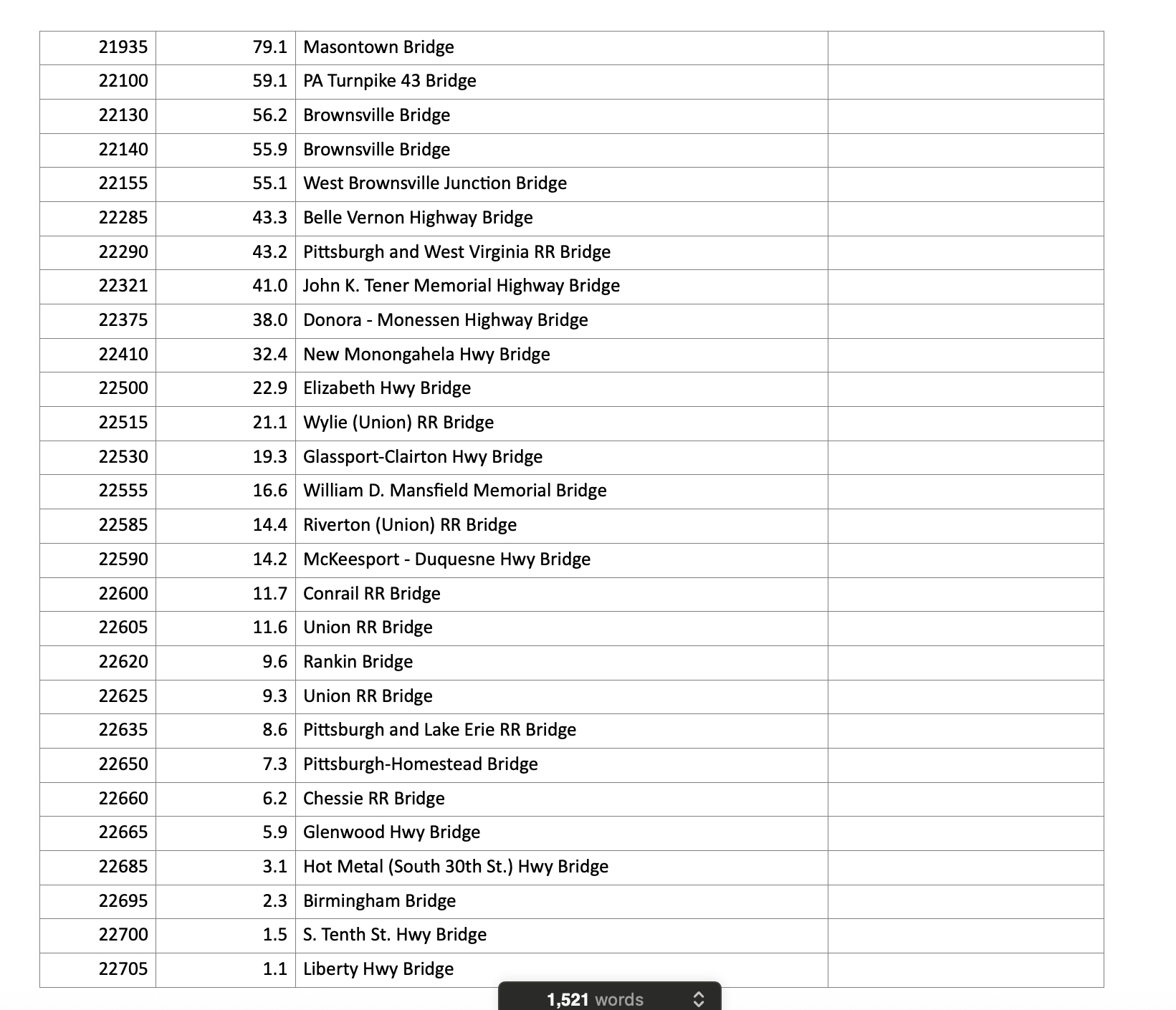
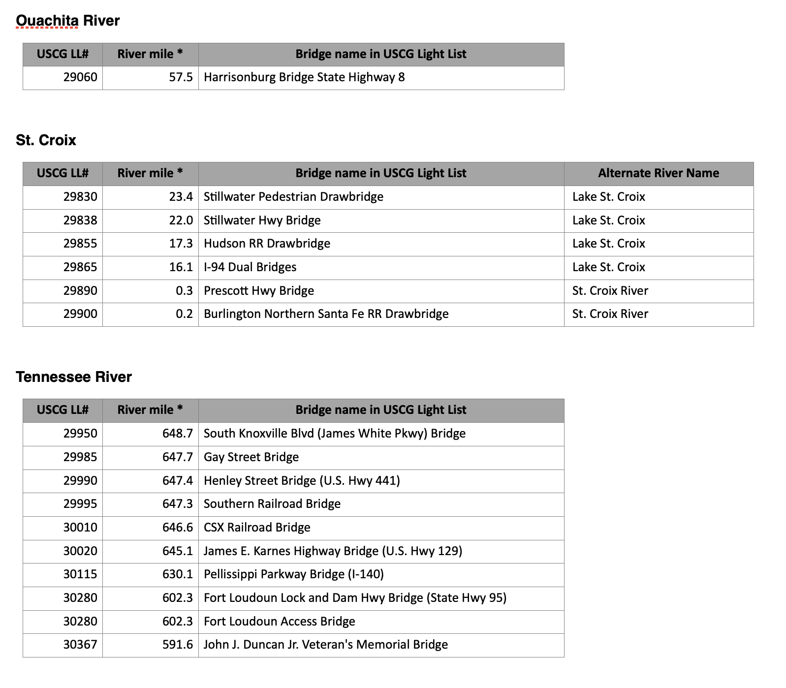
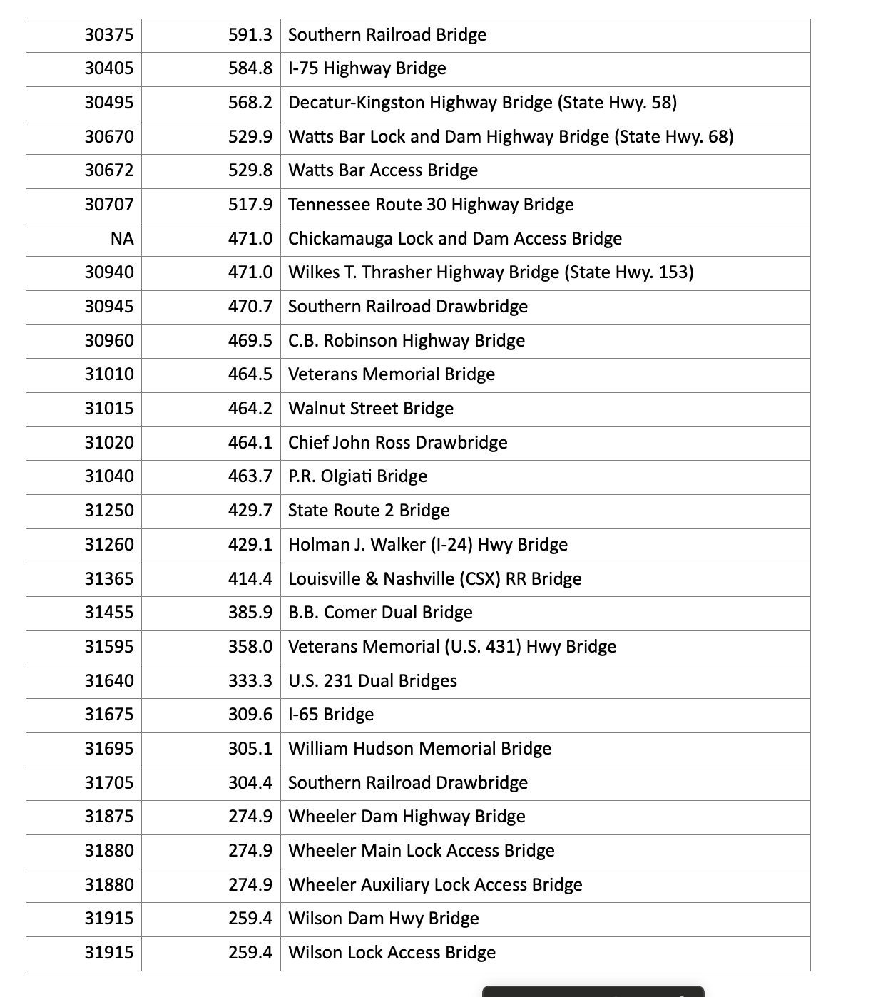
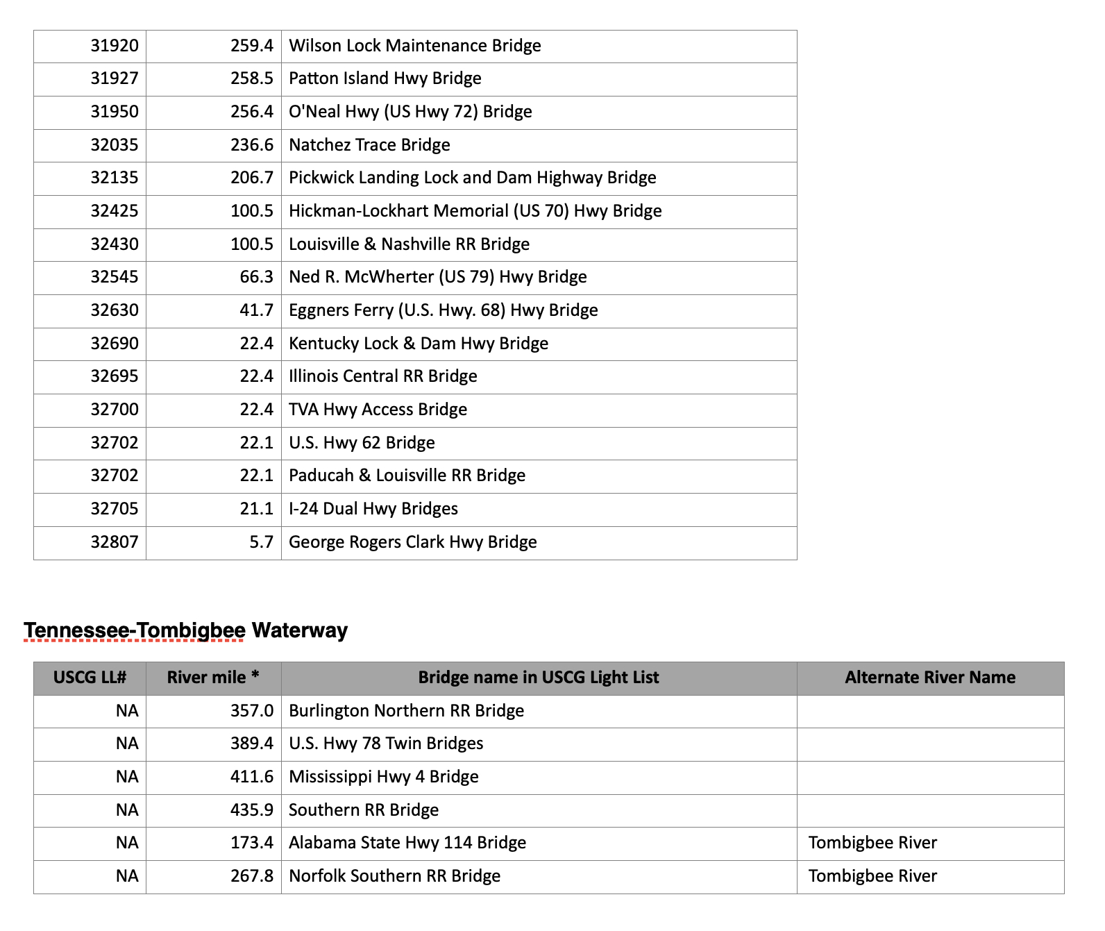
Below is a list of rivers (and the respective number of bridges) where the Corps lacks bridge photos.
- Allegheny River, 22 bridges
- Arkansas River, 3 bridges
- Clinch River, 3 bridges
- Cumberland River, 7 bridges
- Green River, 1 bridge
- Hiwassee River, 1 bridge
- Illinois Waterway, 4 bridges
- Kanawha River, 6 bridges
- Kaskaskia River, 1 bridge
- Lower Mississippi River, 2 bridges
- Upper Mississippi River, 18 bridges
- Missouri River, 9 bridges
- Monongahela, 43 bridges
- Ohio River, 12 bridges
- Ouachita River, 1 bridge
- St. Croix River, 6 bridges
- Tennessee River, 54 bridges
- Tennessee-Tombigbee Waterway, 6 bridges
Featured image caption: An example one of the Corps of Engineers’ Inland Electronic Navigational Chart entries, which shows the Louisiana and Nashville Railroad drawbridge over the Green River. (Courtesy of the Corps of Engineers)


