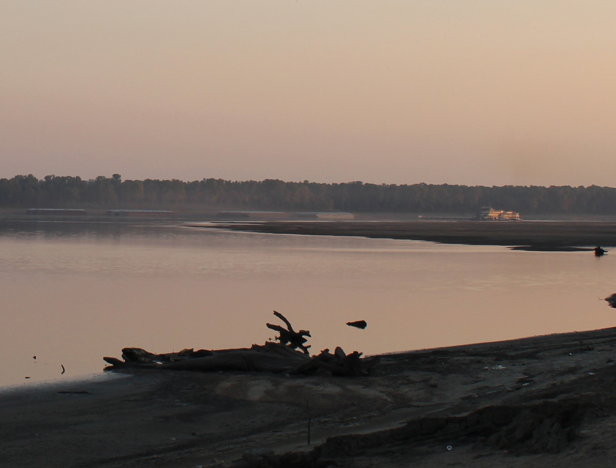
Widespread drought is causing low-water conditions on many of the nation’s navigable rivers, with draft and tow-size restrictions in effect and no end in sight.
Donnie Williams, chairman of the Lower Mississippi River Committee (LOMRC), said even a forecast calling for a small frontal system coming across the Upper Mississippi in the coming days did not appear to be helpful in the long-term.
“It’s not enough to turn anything around, but it may slow the recession downriver some,” he said. “The next couple of weeks, there’s no real relief in sight.”
David Welch, development and operations hydrologist for the Lower Mississippi River Forecast Center, said the official 16-day and two-day Mississippi River forecasts were basically the same with persistent low-flow conditions on both the lower Ohio and Upper Mississippi affecting the Lower Mississippi.
“Stages look to remain below 10 feet at Cairo for the next 28 days,” he said in an emailed forecast on September 17.
Lower Miss Restrictions
LOMRC, working closely with the Coast Guard and Corps of Engineers, set restrictions on traffic on the Lower Mississippi, effective September 19.
Southbound drafts were to be 10 feet and a maximum of six barges wide from the confluence of the Ohio River at Cairo, Ill., down to Mile 483 (Lake Providence.) From Mile 483 south, the maximum draft was set at 10 feet, 6 inches and a maximum width of six barges. Northbound traffic from Mile 303 (Old River) to Cairo was restricted to a 9-foot draft and a maximum width of six empty barges or four loaded barges, with tows to be no more than seven barges long.
The dredge Jadwin arrived at Mile 710 (Nelms) on September 17 and was expected to dredge for the next seven days, with rolling river closures taking place as needed between Miles 708 and 712. One example was that all traffic was stopped between 3 p.m. September 17 and 6 p.m. September 18, according to the Coast Guard.
A major trouble spot was Mile 921, at Hickman, Ky. The dredge Potter arrived on September 15 and was expected to continue dredging for about a week along the right descending bank, Williams said. The Coast Guard advised mariners to be on the lookout for tender boats, barges, small survey boats and pipeline when transiting the dredge area. Work was to continue 24 hours a day, seven days a week. For passing arrangements, vessels were to contact the dredge Potter on channel 13 or 16 and to transit at their lowest safe speed to minimize wake and to proceed with caution after passing arrangements had been made.
Williams noted that, when the Cairo gauge drops to 7 feet, traffic will have to transition to the right descending bank at Hickman to get around the rock pinnacles on the riverbed. That restricts the channel width to a maximum of 600 feet.
A 7-foot gauge reading at Cairo would also likely mean cutting traffic to a maximum width of five barges and daylight transit only in that area, Williams said, calling it “treacherous.”
Williams praised the Coast Guard, noting that buoy tenders were trying to run on a two-week schedule to keep the channel clearly marked.
“The buoy tenders are doing an amazing job trying to stay on top of it as much as they can,” he said.
One issue has been inconsistency in the river levels just upstream from Cairo, he said. An example was the lower gauge at Olmsted Locks and Dam was at 13.2 feet at 10:45 on the night of September 16 and 10.5 feet the morning of September 17.
“So it dropped 3 feet,” he said. “That causes the problem at the Cairo gauge.”
He attributed the sudden drops to the need for peak power at hydropower plants upriver, especially on the Tennessee River. With temperatures still in the mid-90s during the daytime in western Kentucky and Tennessee, those plants were using more water to meet peak power demand during daylight hours, he said. That meant more water being released downriver during the day but held back at night.
“There’s no real defined solution to this at Olmsted to prevent these drops, which affects Cairo, which affects Hickman,” Williams said. “We usually don’t see these drops and peaks at Olmsted until Cairo gets to 10 feet and falling, so right now is a critical time.”
Widespread Effects
While Williams said the last thing he would want is a hurricane disrupting the system, this year’s hurricanes have stayed mainly on the East Coast or out in the Atlantic. In turn, fewer weather systems have trained on the Ohio, Cumberland and Mississippi valleys. That has caused an overall lack of moisture in a widespread area, he said.
Additional barge fleeting has been put in place on the Lower Mississippi River due to low-water conditions at Miles 585-587 (Rosedale), Miles 687-690 (Tunica), Miles 781-785 (Osceola), Miles 846-849 (Caruthersville) and Miles 833-834 and 837-839 (Cottonwood Point).
On the Upper Mississippi River, the dredge Angela K was operating at Mile 793.2 Monday through Friday from 7 a.m. to 7 p.m. until further notice, the Coast Guard reported September 16. Mariners were requested to contact the dredge on VHF channel 12 and 13 30 minutes prior to transiting the area.
The captain of the port for Sector Ohio Valley issued a safety advisory indicating that the dredge Bill Holman would be dredging September 16-22 at Ohio River Mile 855 (Raliegh Bar) 24 hours a day, seven days a week, until finished. The disposal pipeline may be crossing the navigation channel, requiring it to be opened for passing vessel traffic, the Coast Guard said. The dredge was to be contacted on Channel 13 for passing instructions.
On September 17, the Coast Guard advised mariners of low-water conditions on the Red River in “the Gauntlet,” Miles 34 to 42. The 9-foot navigation channel would be lost when the gage at Acme, La., reads 7.5, according to the notice.
“Mariners shall ensure that transit occurs only during water levels above 7.5 on the Acme gauge,” the notice read.
On the Illinois River, Miles 50-80.2 were in a low-water watch phase, with deep draft tows advised to depart the area and all vessels directed to transit at a slow speed near fleeting areas to minimize impact due to narrow channel width. Tow operators were advised to place the heaviest barges in the middle of the tow and to identify fleeting areas in the event of a river closure. The Missouri River, from Mile 200 to 300, was in a low-water action phase with the same directives given. Notices from September 11 had indicated low-water issues from Miles 0 to 100 and 100 to 200 as well, with mariners urged to use caution.
No Tenn-Tom Restrictions
Mitch Mays, administrator of the Tennessee-Tombigbee Development Authority, noted that there were no draft or tow restrictions on that system, which regularly maintains a 9-foot draft and locks that can accommodate eight barges.
The northernmost lock, Jamie Whitten Lock and Dam (Tenn-Tom Mile 411.9), was closed for routine maintenance until October 3, however.
Traffic coming up the Ohio River would also have to detour to the Cumberland River at Smithland, Ky., transit Barkley Locks and Dam, then take the canal between Lake Barkley and Kentucky Lake to move upriver on the Tennessee due to a full closure at Kentucky Lock (Tennessee River Mile 22) beginning September 22. Kentucky Lock is to be dewatered for repairs until 6 p.m. October 16, then opened until 4 a.m. October 20 for through traffic before being closed again through November 21.
————
Featured photo caption: The dredge Potter works on the Lower Mississippi the evening of September 17 at Hickman, Ky., (Mile 921) as seen from the Dorena-Hickman Ferry landing in Dorena, Mo. The ferry service remains closed due to low-water conditions. (Photo by Shelley Byrne)


